
I live in a pretty cool state. We have amazing mountain peaks, red rock cliffs, famous delicate arches, and the Great Salt Lake. The geography attracts millions of visitors to our national parks in Southern Utah. Up north, our mountain peaks covered in snow bring in the thrill seekers to our ski resorts. A lesser know location, the Bonneville Salt Flats, a left over ancient lake bed called Lake Bonneville, collects miles of rock salt in an extremely flat location. The salt is left over as rain water collects on the flat lake bed and evaporates as the only way to leave.
A geographical wonder, The Bonneville Salt Flats attracts people in awe as they drive past on Interstate 80 between Nevada and Salt Lake City. Years ago the racing world realized the value of the long flat surface, the ability to break land speed records.
Bonneville Speed Week
In 1935, the first person to break the 300 MPH land speed record (LSR) was achieved at the Bonneville Salt Flats. Then again in 1963, someone broke the 400 MPH land record barrier. Followed by the 500 and 600 MPH barriers being broke in 1965. The current Bonneville Salt Flats speed record was set in 1970 with a speed of 622 MPH. The history of that location is well known. Many movies have been filmed on the flats, including “The Worlds Fastest Indian” with Anthony Hopkins.

Every year in early August, the racing community gathers on the Salt Flats for Bonneville Speed Week. Vehicles built for speed gather to attempt to break records. Since the Salt Flats are a long outdoor area, it is a great place for wireless technologies. While I write this, Bonneville Speed Week is happening out there. I pulled up the Salt Flats webcams, and you can see the event setup off in the distance.
Motortrend Magazine says about the event that “volunteers run about 38 miles of wire to support the timing systems and lay out precisely one zillion cones.” My Thought was, what if we could use Private Cellular to cover some of those distances? Let’s go for speed!
Salt Flats
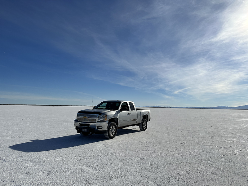
The Salt Flats are somewhere locals go for a weekend party. As we were doing our testing in early October, many people with all kinds for vehicles went to speed across the salt. Some raced their Mustangs and Telsas, others were there just to take in the view.
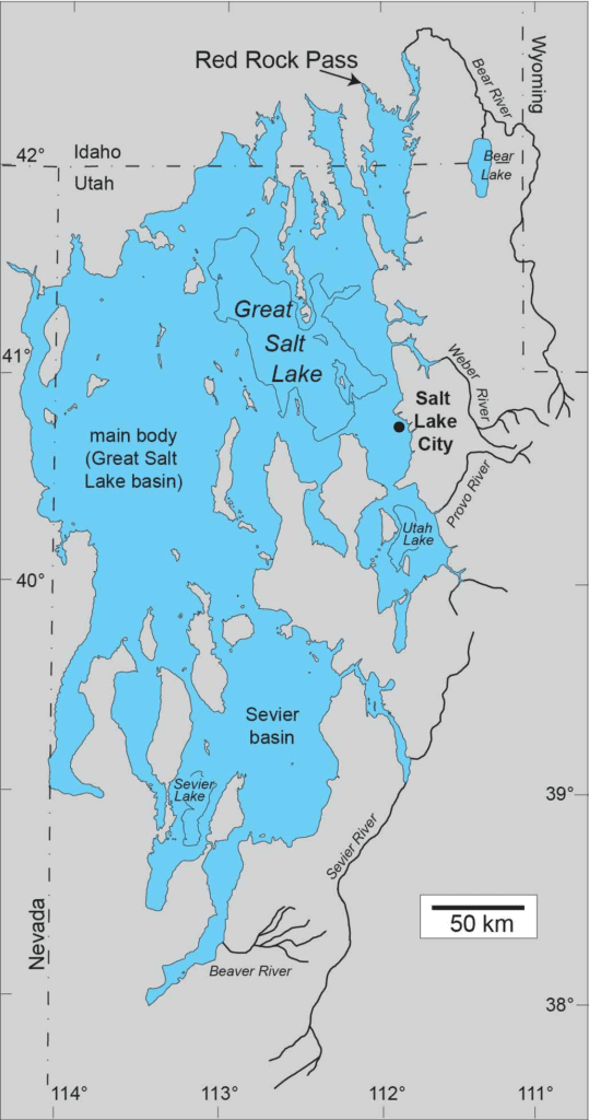
As I mentioned, the Salt Flats are remnants of a massive ancient lake called Lake Bonneville. Three lakes are left over from the original Lake Bonneville: the Great Salt Lake, Utah Lake near Provo, and Sevier Lake in central Utah.
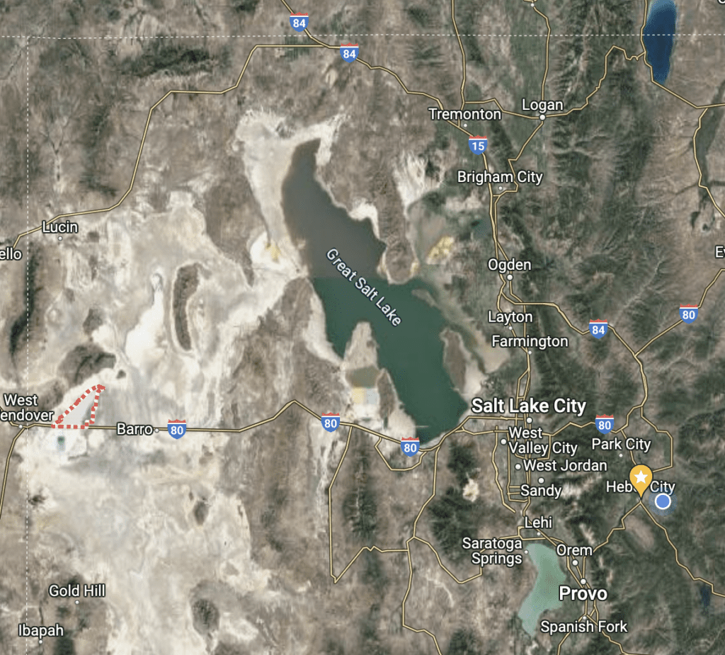
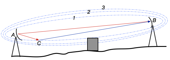
The Bonneville Salt Flats are located in the red and white dotted line below. A couple hours drive West of Salt Lake City on the side of Interstate 80, just east of Wendover, Nevada. The remnants of Lake Bonneville are visible from the satellite imagery on Google Maps.
Wifi Distance Testing
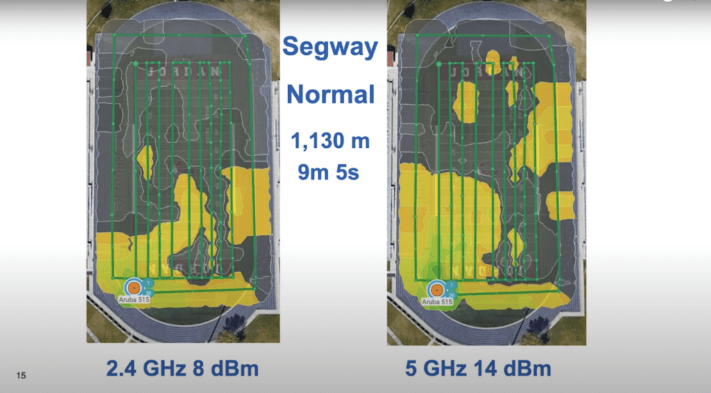
My good friends, Ferney Munoz and Keith Parsons from WLAN Professionals, as they often talk about, wanted to do some distance testing with different Wifi AP Omni-directional antennas. They started testing at a high school football field in the suburbs of Salt Lake. They soon realized there were issues. Reflections off the surrounding buildings and bleachers would extend the connection where it would fail in other closer locations. The reflections would cause data irregularities in their measurements.
At WLPC Phoenix 2023, Ferney talked about the issues and showed several slides. He talked about how they tested the Wifi signal while walking, while on his Segway, and while driving a car.
As a quick side note, at my schools, I’m installing Private Cellular at high school football fields to cover this area with a single radio, verses needing multiple Wifi radios.
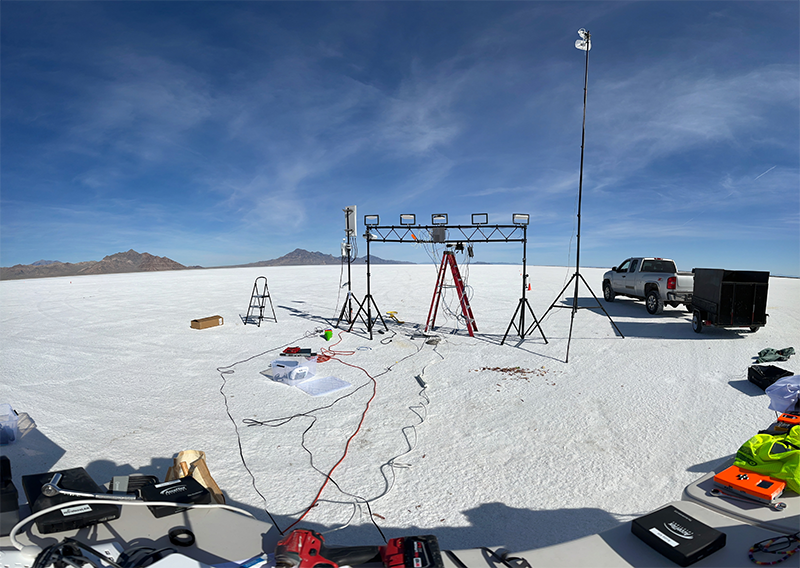
Ferney soon realized they needed a new location to do the testing to reduce the reflections. The Salt Flats soon became Ferney’s favorite testing site. He has journeyed out there several times for testing Wifi networks. Because of his testing, one day in late summer 2022, I had the thought of testing out Wifi and CBRS out on the Salt Flats. I called up Ferney, and it was soon planned for a weekend in October sandwiched between WLPC Prague and WLPC Mexico.
Ferney discussed the issues he ran into testing Wifi and gave an overview of the project at WLPC Phoenix 2023.
On the Salt Flats, with Ferney’s towers we tested various vendors Wifi APs. We had radios from Aruba, Ruckus, Ubiquiti, and Mist. Ferney’s Wifi testing had issues with his Ekahau software and the Sidekick 2. Sadly, he didn’t get very good measurements during this testing. His findings he talked about in his WLPC Phoenix TEN Talk.
CBRS Testing with Starlink
Unlike doing testing with Wifi, setting up a CBRS network requires a connection to the Internet for SAS registration and connectivity to the LTE EPC Core. The CBRS radios are not allowed to broadcast until they receive a grant from the SAS. Additionally for most Core vendors, user data traffic is tunneled to the Core or to a drop off box MEC Gateway. In the middle of the Salt Flats, there is no connectivity. The closest cellular towers are located in Wendover, Nevada.
That left us to use Starlink for our backhaul. As I had been testing previously, Starlink worked perfectly!
CBRS Radios
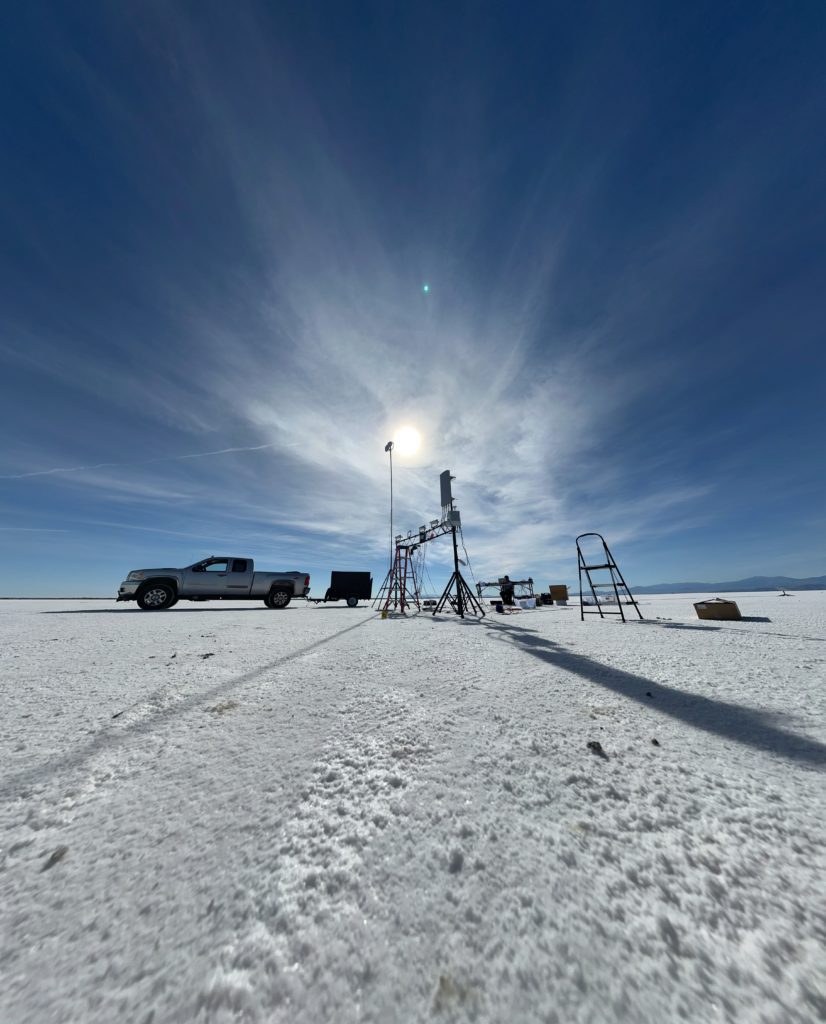
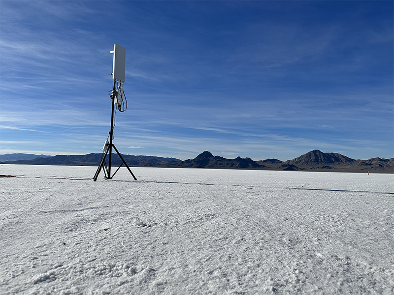
We tested a Celona AP-10, a Ruckus Q710, and a Baicell 436Q. The Celona and Ruckus are technically indoor radios and limited to Category A with Omnidirectional Antennas; although they become Category B once you use them outdoors. The Baicell is a Category B radio with an external directional antenna. The Celona radio uses their Orchestrator and Core that is in the cloud so it only needed internet connectivity. Our other radios connected to our core and needed a VPN connection.To reduce the reflections, we move all the vehicles to a safe distance off away from the testing site.
Distance Testing
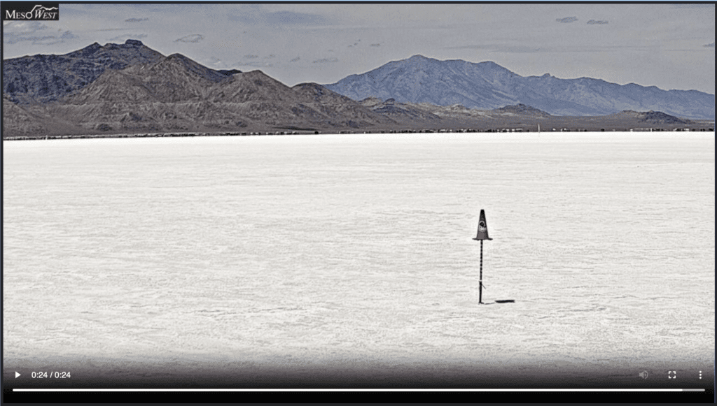
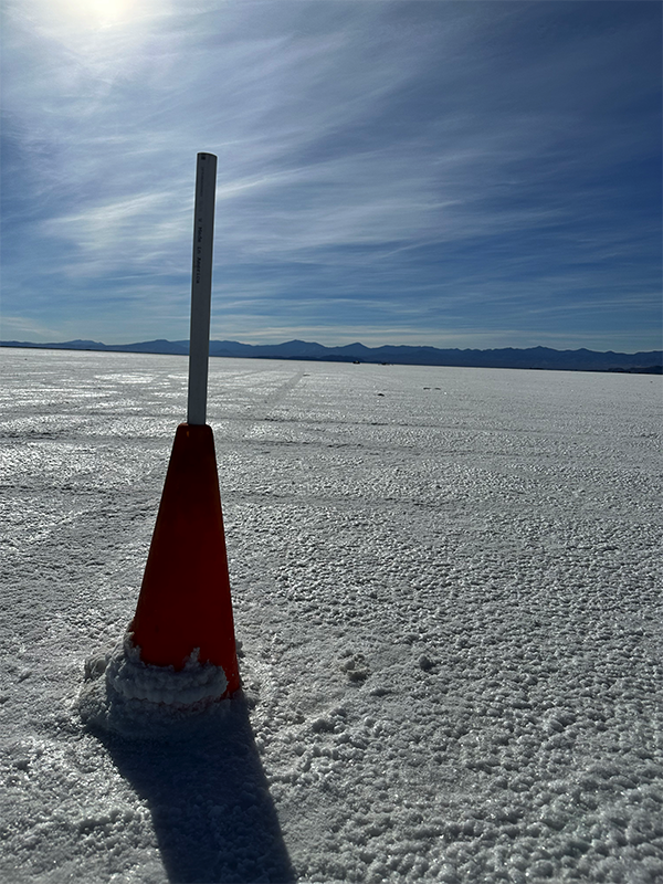
To give us a scale, we used some orange cones that were already place every quarter of a mile. The first cone at the first quarter mile looked like this image below. You can barely see the vehicle and the radios at even that distance. It got even harder the further you went.
Testing Measurements
Since we didn’t have the cool expensive tools for measuring LTE, we were left to test with EU devices. I had my CBRS Pi but that was difficult to use to test. Instead, we came up with the idea of using SpeedTest.net. If I have an opportunity to do this again, I would use an onsite MEC gateway with a local speedtest server. That way we wouldn’t be testing the Starlink backhaul, just the CBRS radios and local network. How the Core network works, we couldn’t run a local speedtest server because all the user traffic for the Baicell and Ruckus radios was being tunneled to our MEC gateway then dropped off to the internet.
We used a bunch of UE devices. I had a Google Pixel 6, and an iPad Pro 2022. My buddy, Jason Eyre, had a several Cradlepoint CPEs, a CTL Chromebook, a Windows Laptop, and an Inseego Hotspot.
Indoor Category A Radios Testing Results
My first testing was to see how far the two Indoor Category A radios could be usable; since, they are lower powered devices. Category A Radios are limited to 24dBm per 10MHz channel of power. That is compared to the 30dBm or 1 Watt that is available to CBRS Category B radios.
Instead of driving, I started my testing with walking using my Google Pixel 6 smartphone and CBRS Pi. With my Pixel 6, I lost connectivity just after the first cone at the first quarter mile. The Indoor Category A CBRS radios, Ruckus Q710 and Celona AP-10, would only make it quarter of a mile. That lower allowed power and use of an omnidirectional antenna reduces the distance of the radio by a massive magnitude.
Outdoor Category B Radio Testing Results
We then transitioned to testing the Baicell 436Q Category B radio. We were able to check the actually RSRP measurements on two of the devices. The Google Pixel 6 and the Cradlepoint E300. I graphed those results below and they were fairly close until the Google Pixel 6 lost connectivity. The measurements were obtained every quarter mile at each quarter mile cone. The Pixel lost connectivity just after 2 miles, the Cradlepoint lost connectivity after 2.25 miles.

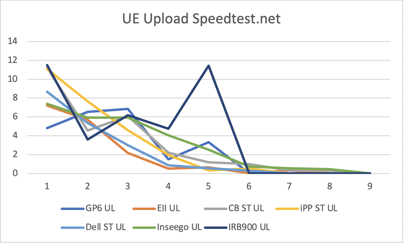
Our other test was to use Speedtest.net to see if the device could communicate with the internet. I graphed the speedtest results for both uplink and downlink below. Each number along the bottom is, like above, every quarter mile. Most devices lost connectivity after about 2 miles. The Inseego and Chromebook were able to communicate at 2.25 miles. The further we went the lower the speeds were, but they were still working up to that 2.25 miles when we gave up.

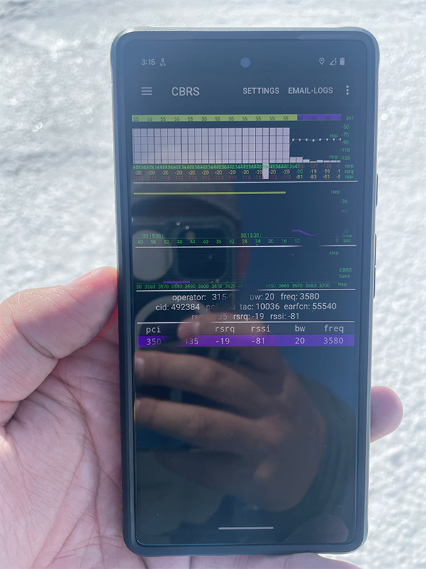
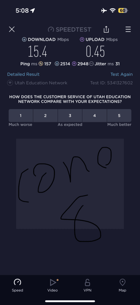
My iPhone connected to one of the Cradlepoint devices with Wifi gave me these results at Cone 8 or 2 miles away. This is still usable. It’s not the best experience but usable.
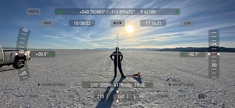
When we got to the 9th cone at 2.25 miles, I had to use Theodolite to verify in which direction the radios were located. All but the Chromebook and the Inseego Hotspot dropped off before cone 9. Those two devices were barely usable so we knew we were at the edge of the usable signal.
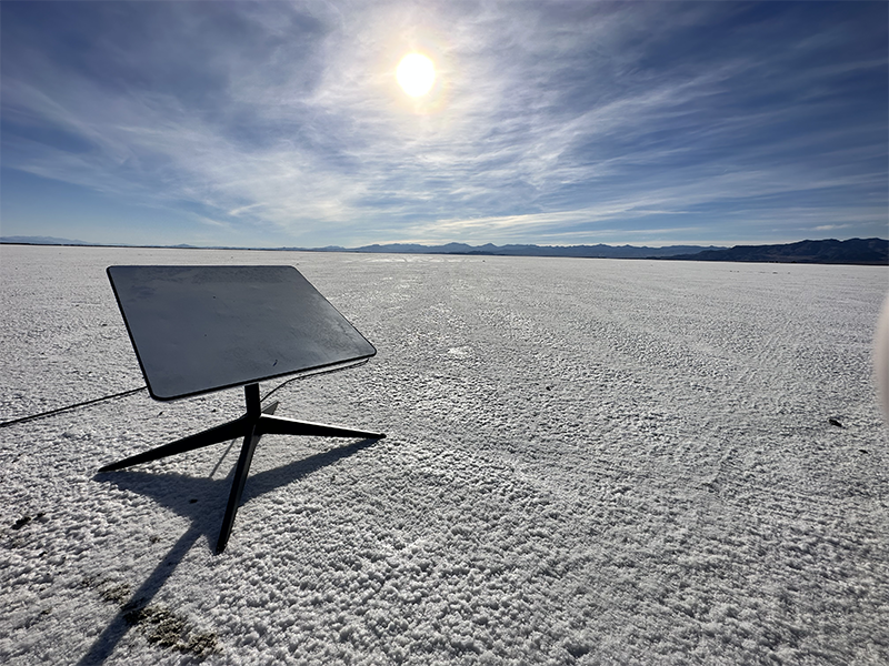
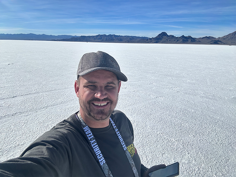
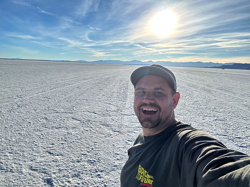
We expected to get further distance than that but were excited to see the results. The radios are so far away, the naked eye cannot see it against the white salt. In this picture the radios are right above the brim of my hat.
Refractive Index and Fresnel Zone Issues
When you use a radio to go distances there are a few things you need to take into account. Unlike designing for Wifi inside a building, there are some characteristics of radio waves that we need to worry about. The first one is that we need to worry about the Fresnel Zone. Also since we are broadcasting across salt, we need to worry about how salt reflects radio waves.
The Fresnel Zone is a oval shaped area that exists around a Point-to-Point link. For connectivity you need about 60% clearance in the first Fresnel Zone without obstacles. An 80% clearance is recommended if possible. That is why many radio towers are situated on super tall towers or masts often on top of buildings or mountains.
When we planned this, we didn’t have a very tall mast to place the weight of the CBRS Radio and Antennas. We had about a 15 feet tall mast that could support the weight. That became an issue for our testing. I hope to redo this testing out there with a higher mast.
CBRS 3.55GHz has a Fresnel Zone clearance requirement of about 27 feet at 2 miles. Our 15 feet wasn’t clearing the Fresnel Zone. That would cause the distance to be much less than possible for this testing.
The second thing we need to worry about is reflectivity of the ground. As the waves cross the ground, they will hit and act in several different ways. They may reflect, refract, scatter, or be absorbed. At the time I had no idea the reflectivity of rock salt was. I had to do some research to find it. Eventually, I found that Rock Salt has a refractivity index score around 1.54. Wikipedia says it is around 1.516. Wikipedia also talks about the refractivity index here.
I gave a presentation to some coworkers about this testing at a conference in January 2023. A good friend that has been working for the state said they once did some tests to shoot radios across the Salt Flats and had issues because of the refractivity index of rock salt. He said it acts similar to a lake. Water has an index of 1.333. Not quite the same refractivity index but close. Both of these issues affected our results, but we were excited to get 2 miles with these issues. If we had accounted for the Fresnel Zone with a higher mast, we could possible expand the distance even further. To test with the salt refractivity index issue, we need a different location.
The Final Results
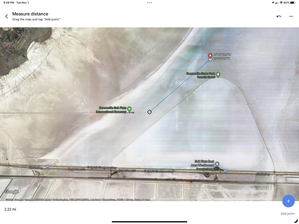
I took coordinates of my phone and mapped them on Google Maps. We ultimately got 2.25 miles at the max; while most dropped off at 2 miles. We consider the test to be super successful. It was super cool to see that distance overlaid on Google Maps.
After the test, I came up with these ideas for future testing if we get back out there.
Requirements for future tests:
- Higher Tower – Fresnel Zone
- Better Planning
- Control the Uncontrolled Variables
- Local MEC Gateway
- Local Speedtest Server on WLAN Pi Pro
- Professional Measurement Tools
- Measure in back of Truck or on Ferney’s Segway
Future Testing Ideas:
- Tower Height to Fresnel Zone/Distance Improvements
- Better Category A and B eNodeB Testing
- Different Antenna Testing
- Additional Client Testing
- Heat Map with Professional Tools
- Testing “Speed” of connectivity – ie vehicle speed while moving
Disassembly
As we were taking down the radios, I decided to capture a time lapse video of Jason Eyre disassembling the radio. It turned out to be a cool time lapse.
Surprise Distance Challenge Result
As we were driving home, we passed through an area where we have one of these Baicell 436Q radios installed on top of a high school. The freeway is located about 12 miles from that high school. I was driving and Jason was riding shotgun. We had heard from that school district that they were getting crazy distances. So, we wanted to see what we could get.
When we came around the hill and got a visible line of sight of the town, Jason pulled out his Chromebook. To our shock, he had connectivity. So he pulled up speedtest.net. We were even more shocked to have a usable signal. He was pulling about 3 Mbps down and less than 1 Mbps up.
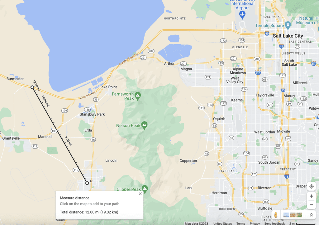
The tower was located on the roof of a high school. The geography is that the school sits up on the hill and there is a lower valley between where we were driving and the school with a perfect line of sight. We were using the CBRS Band 48 with the Baicell 436Q and a directional antenna at 12 miles. We had an ongoing distance challenge amongst our group and with that result we set the standing record. The other crazy thing is that we were driving along going the freeway speed limit of 80 MPH on Interstate 80 in that section.
Final Thoughts
Ultimately, the entire test was successful. There were a lot of stuff we didn’t think about in our planning. It was a last minute trip. Getting 2 miles over salt without a tall tower is crazy and even crazier was the 12 miles with an existing install. Obviously, all this testing is with perfect line of sight. No trees, buildings, or anything else is in the way. Real world in most locations are going to get much shorter distances. We ultimately wanted to see what distances we could get. I didn’t expect to set the distance challenge while driving home.
Like the speed demos on the Salt Flats looking for Land Speed Records, our CBRS testing was a success. We didn’t set the distance challenge records on the flats. BUT we did have a great time and learned about Private Cellular using the CBRS band for future projects. This project has already had useful applications since the initial testing. We hope to get back out there and do some more testing soon!